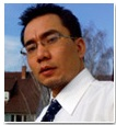
Prof. Bakimchandra
Oinam
Professor
civil engineering
NITM
FACULTY
PROFILE
My personal viewpoint on GIS Technology and its Applications and particularly what “Geospatial Revolution” could mean to all of us?
“We have experienced various revolutions in the past, such as the Industrial Revolution and the Green Revolution, both of which changed society and all our lives. It was during the late nineteenth century that the world of GIS and remote-sensing education and its applications began its ascent the Western and Eastern scientific world. This multi-dimensional change in scientific outlook and its synergetic effect on existing fields of science might be termed the ‘Geospatial Revolution’.
This revolution led us to acquire and update our knowledge to suit the needs of high-end research in both the corporate and the scientific world. Nowadays GIS cannot be ignored when it comes to decision making and natural-disaster mitigation. Using GIS to solve, strengthen and cope with various complex real-world issues and problems has become a way of life for us.
Stepping into the geospatial field made me realise that it was not the colourful map alone that had to be dealt with, but a range of colourful and innovative ideas and challenges that could be applied to any field of science. It is a field of opportunity that I would like to call ‘Digging for the Ultimate Gold (or Goal)’.At this moment, within the realm of this revolution, I am not sure whether I am digging for my career goal in life, or ultimate gold in terms of work satisfaction – financial stability. But what is important and known to me is that we are all part of the global Geospatial Revolution. Maintaining an inquisitive and explorative attitude can, I believe, lead us into a constant learning process and contribute towards further development. The advancement of Information Technology, GIS and Remote Sensing Technology adds an immense potential for innovation and excellence. This is just the beginning; we are yet to see its transformation for a better world.”
- Extracted from the Feature article published by Oinam Bakimchandra, May (2009)GIM International, Netherlands
Research Focus: GIS, Remote sensing and Spatial Statistics
I am working in areas of a) geostatistical methods/spatial interpolation techniques to generate a continuous precipitation surface for a complex topography; b) understanding the role of GIS to capture and model the concept of Resource Management Domain (RMD) for sustainable Agriculture and c) developing a research methodology ( with reference to LADA framework) for understanding and mapping the land degradation at multi- scale. Since 2011, I have supervised many Post Graduate students in areas of feature extraction (Urban Road) from high resolution satellite data using fuzzy logic, habitat suitability modeling, forest fire risk assessment modeling, hydrological modeling, landslides hazard mapping, urban green space mapping, dasymetric mapping for generating gridded population and rainwater harvesting potential zone assessment etc.
Two PhD scholars are actively working with me in areas of spatial interpolation for exploring the spatial variability of rainfall in complex topography (Uttarkhand, India) and application of GIS in characterizing the RMD for sustainable agriculture (Mewat, Haryana, India ).
Any potential candidate who is enthusiastic and determine to carry out their master and PhD studies can write to me (Email: bakim@nitmanipur.ac.in) directly by expressing their research interest with a detailed CV and outline 1-2 pages of their proposed research work.